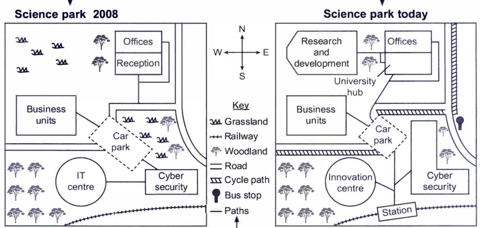
The maps below show a science park in 2008 and the same park today. Summarise the information by selecting and reporting the main features, and make comparisons where relevant.
The maps compare the image of the Science park in 2008 with the picture of the current park.
Looking from an overall perspective, it is readily apparent that the park retains the basic elements of woodland, railway, offices, and business unit with some new advancements like a bus stop, cycle path, and a station.
In 2008, the park was mostly covered by grass and woods in the northwest and southwest corner, with some trails in the middle. There was a big car park in the middle with links with the road which passes through it and goes to the west, which also connects the business unit and cyber security center through paths. The pathway from the security center leads to the IT center, which was in the west and in parallel was the railway crossing with no links to it. On the northeast corner were the offices and reception, both of which were joined by footpaths to the road running in the middle.
The park now has gone through some major advancements like a new path for cyclists is constructed alongside the road running from west to north-east corner, with a bus stop at the T-point of the road. The car park is now a smaller one and joined with the new station through pathways, which also links to a large cyber security center and an innovation center in place of an IT center.
On the north of the park, reception is now converted to a University hub, and a new research and development center is built in place of grasslands; both of them are cross-linked to offices through paths, which leads to the car park and to the north.
Follow Us on IELTSFever Twitter


Leave a Reply